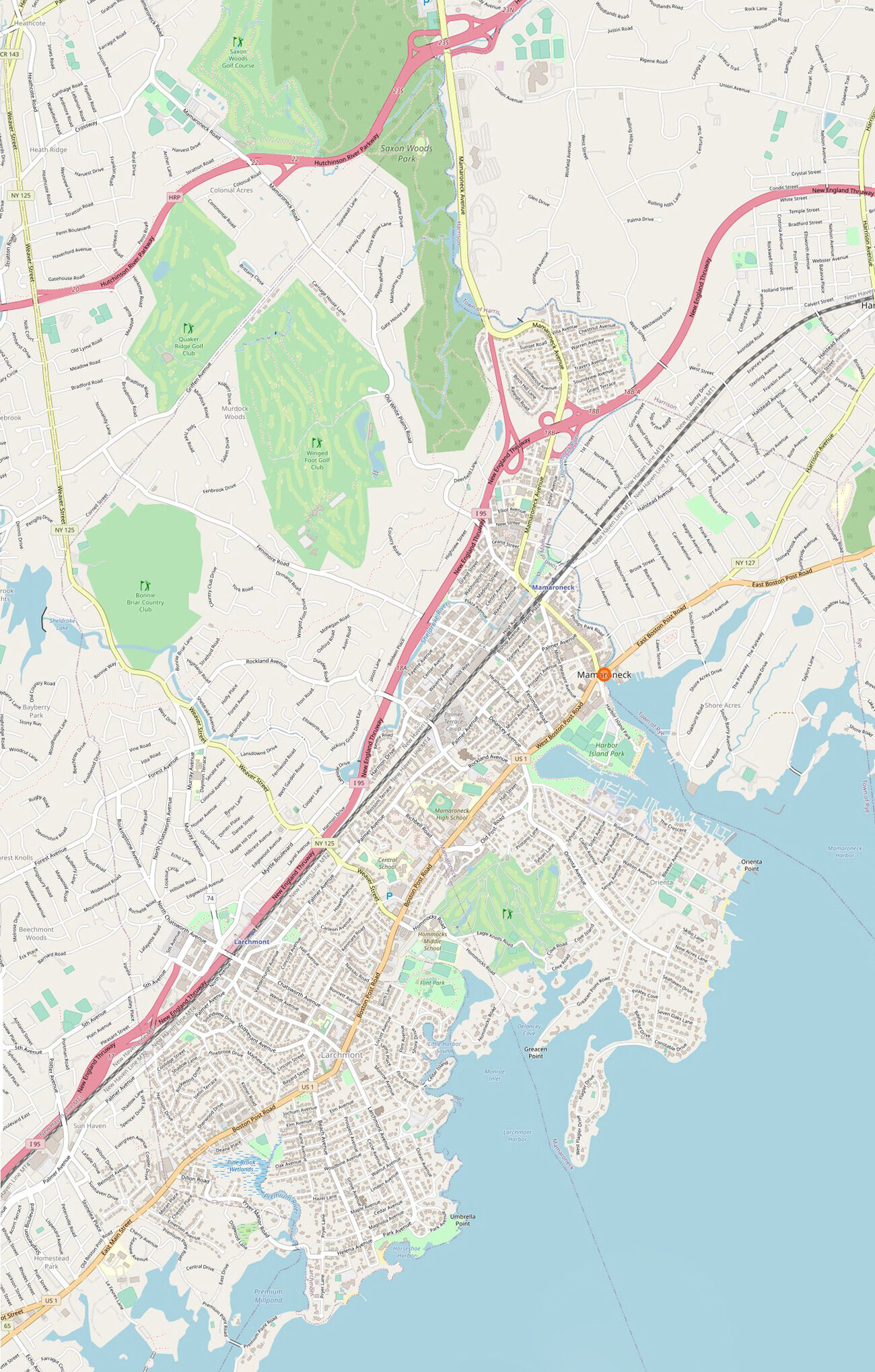
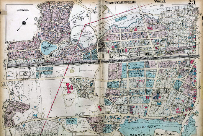
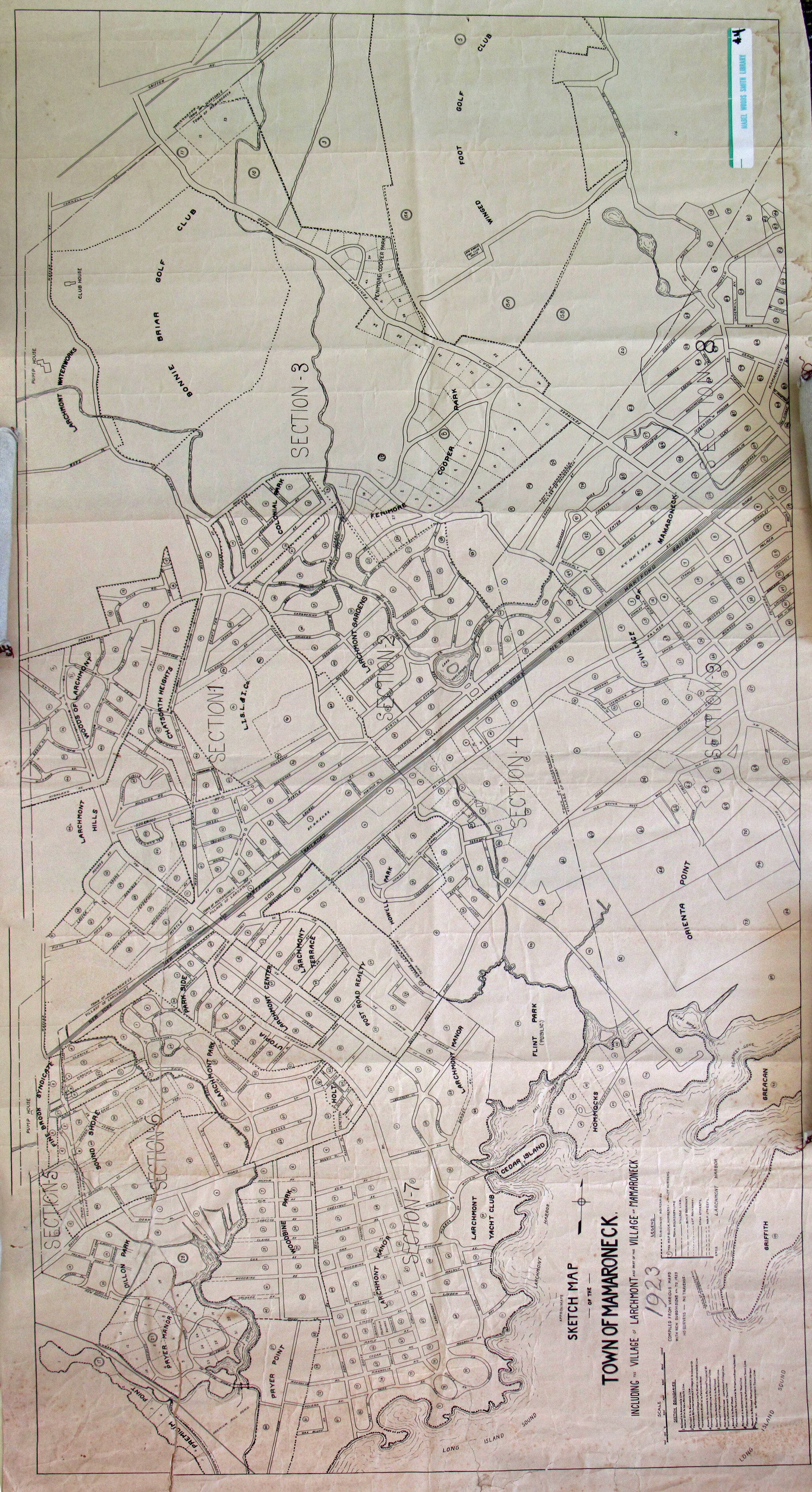
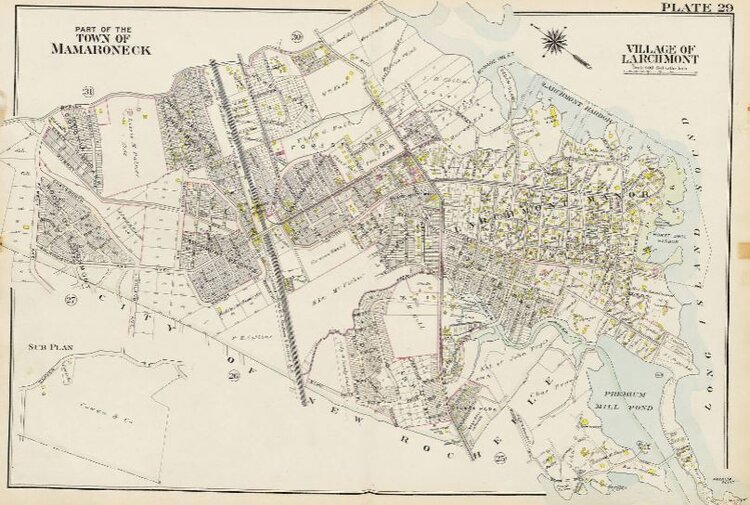
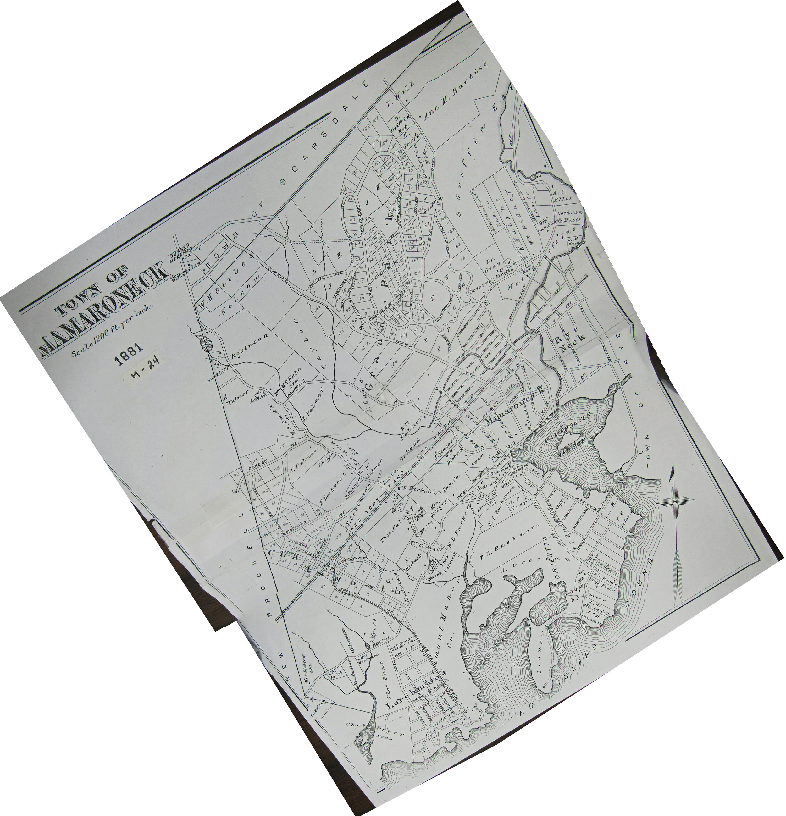
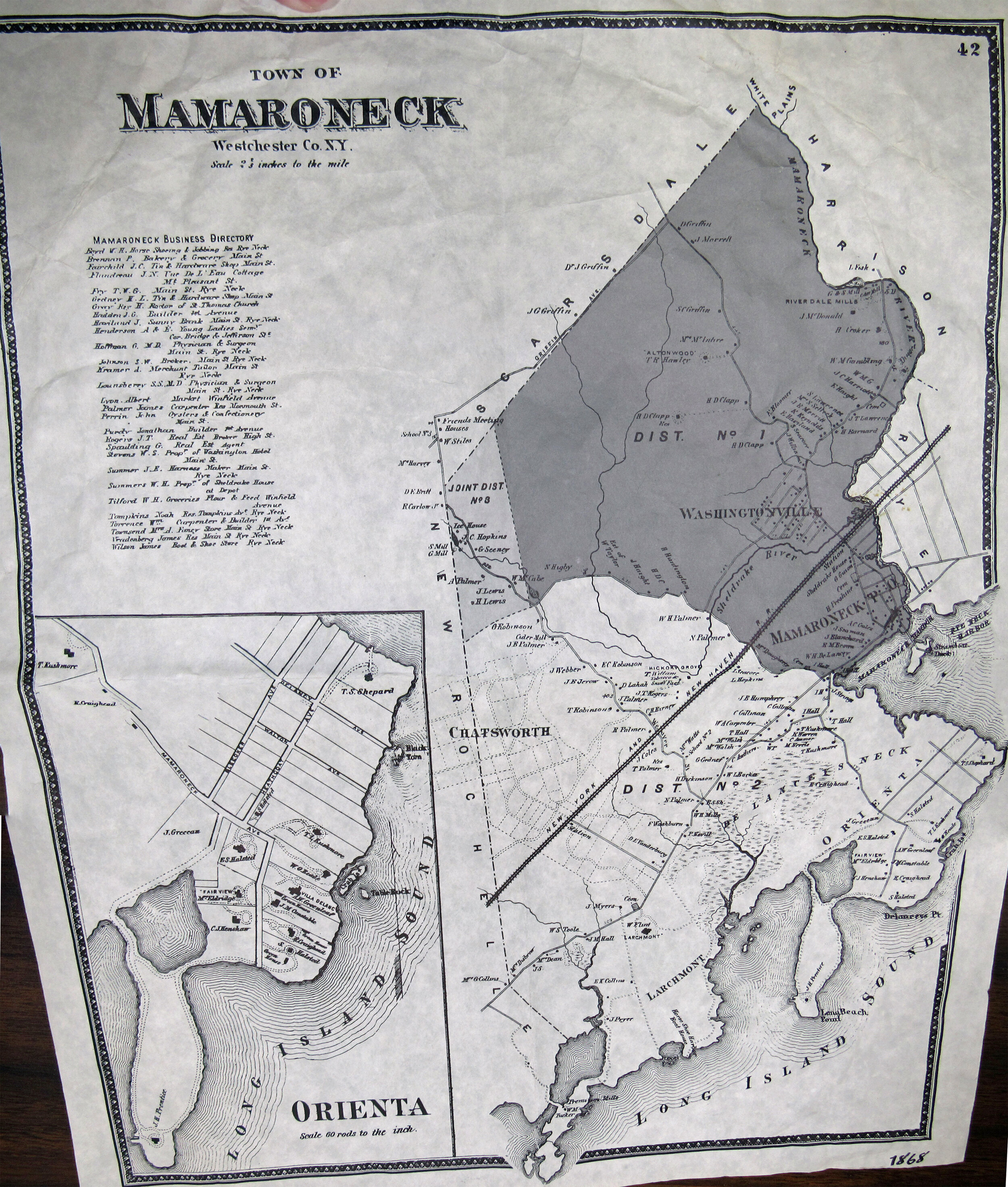
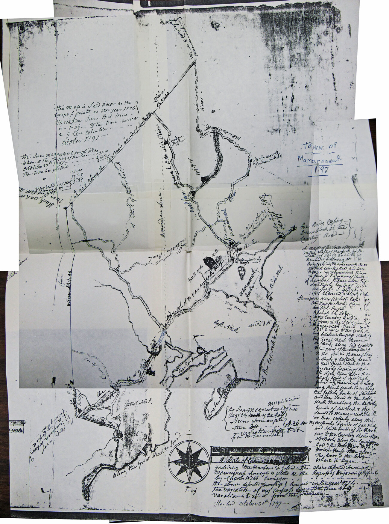
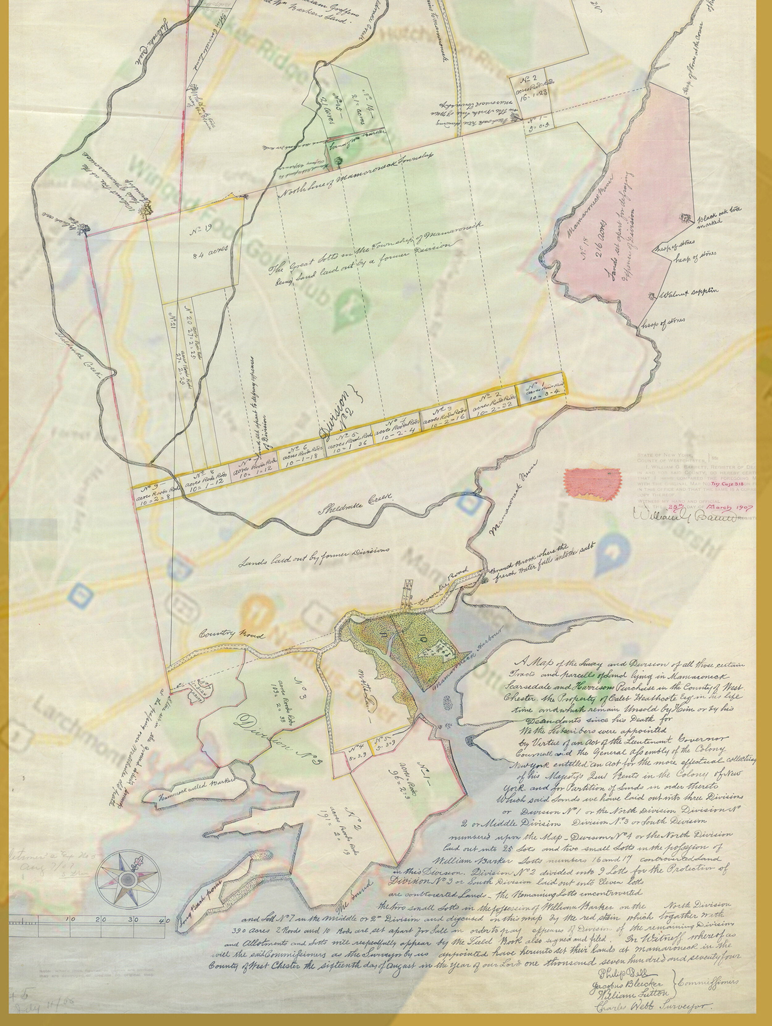
Mamaroneck historic maps dating back to 1774
See old maps of Mamaroneck
See when your street appeared and how the town developed.
How to view maps: Tap on one of the maps below. A larger version will appear in a box below it.
Exceptions:
1911 link will open on a separate web page - Westchester County Archives
1929 link will open to a list of local maps on a county archives web page.
Most maps are aligned so north is up.
Best browers: On desktop, the maps work best on Google Chrome or Microsoft Edge web browsers. Internet Explorer doesn't provide detailed close-up zooms.
See more details on the maps.
See other historic maps, aerial photos:
- Larchmont
- Rye Neck
- Westchester County Archives Digital Collection: Countywide maps and atlases, photographs and more
- Westchester County Historical Society: images, objects and more
- Westchester County Historical Aerial Photographs collection, 1925-95
Zoom and rotate the enlarged map this way:
On computer:
Tap the buttons to zoom or rotate the image and to reset it to its original size and orientation.
Hold mouse down and drag to move the map around.
On a laptop with a track pad:
Tap the buttons to zoom or rotate the image and to reset it to its original size and orientation.
Tap a finger twice on the larger map then hold down to move it around.
On a cell phone:
Tap the buttons to zoom or rotate the image and to reset it to its original size and orientation.
Or spread your fingers across the larger map to zoom in and bring them together to zoom out.